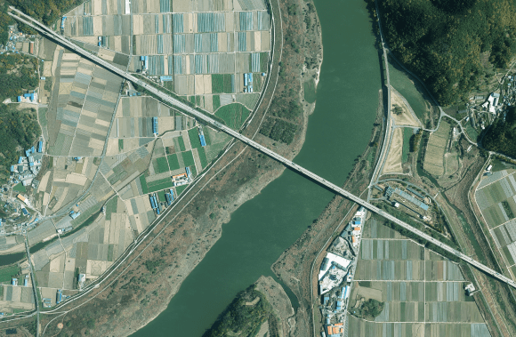
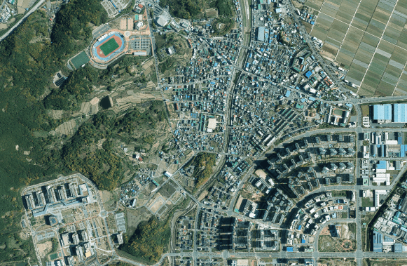
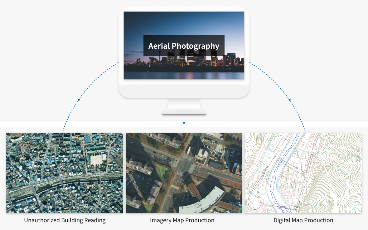
Aerial photography means taking an aerial image of the surface from an aircraft through a digital camera or aerial LiDAR. SHINHAN Aerial Survey is carrying out various aerial photography tasks by installing high-tech map-making digital cameras and aerial LiDAR on aircraft.
Result
Major Application Field
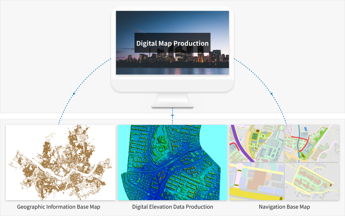
Digital Map Production Procedure
Step. 01
Planning and shooting
Step. 02
GPS/IMU Data Processing
Step. 03
Producing Results
Step. 04
Image(Map) Production
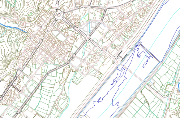
Digital Map Production
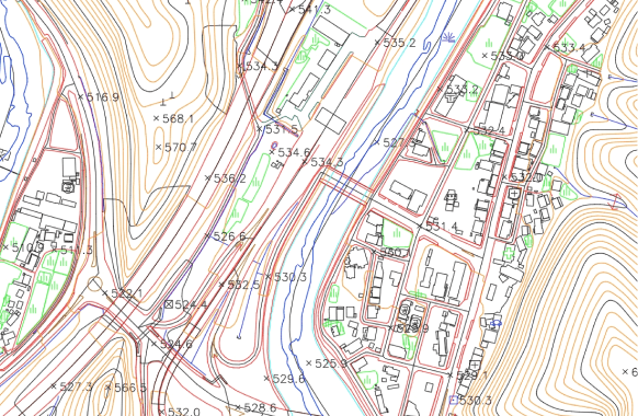
Digital maps refer to maps that digitize geospatial information such as location information and topographic information according to a certain scale, drawing by aerial photographs, digitizing existing paper maps, and local surveys.
Result
Major Application Field
Digital Map Production Procedure
Step. 01
Step. 02
Step. 03
Step. 04
Step. 05
Step. 06
Data Collection
Surveying Ground Control Points
Aerial Triangulation
Digital Restitution
Position Correction Editing
Digital Map Production and Inspection
Step. 01
Step. 02
Step. 03
Data Collection
Surveying Ground Control Points
Aerial Triangulation
Step. 04
Step. 05
Step. 06
Digital Restitution
Position Correction Editing
Digital Map Production and Inspection
Step. 01
Data Collection
Step. 02
Surveying Ground Control Points
Step. 03
Aerial Triangulation
Step. 04
Digital Restitution
Step. 05
Position Correction Editing
Step. 06
Digital Map Production and Inspection
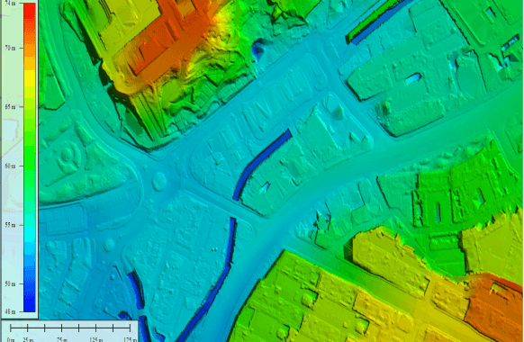
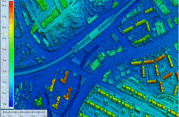
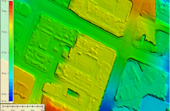
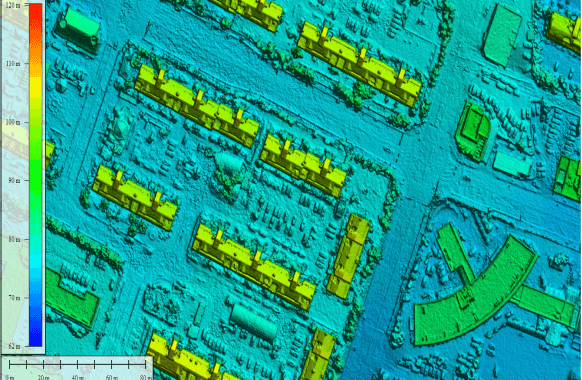
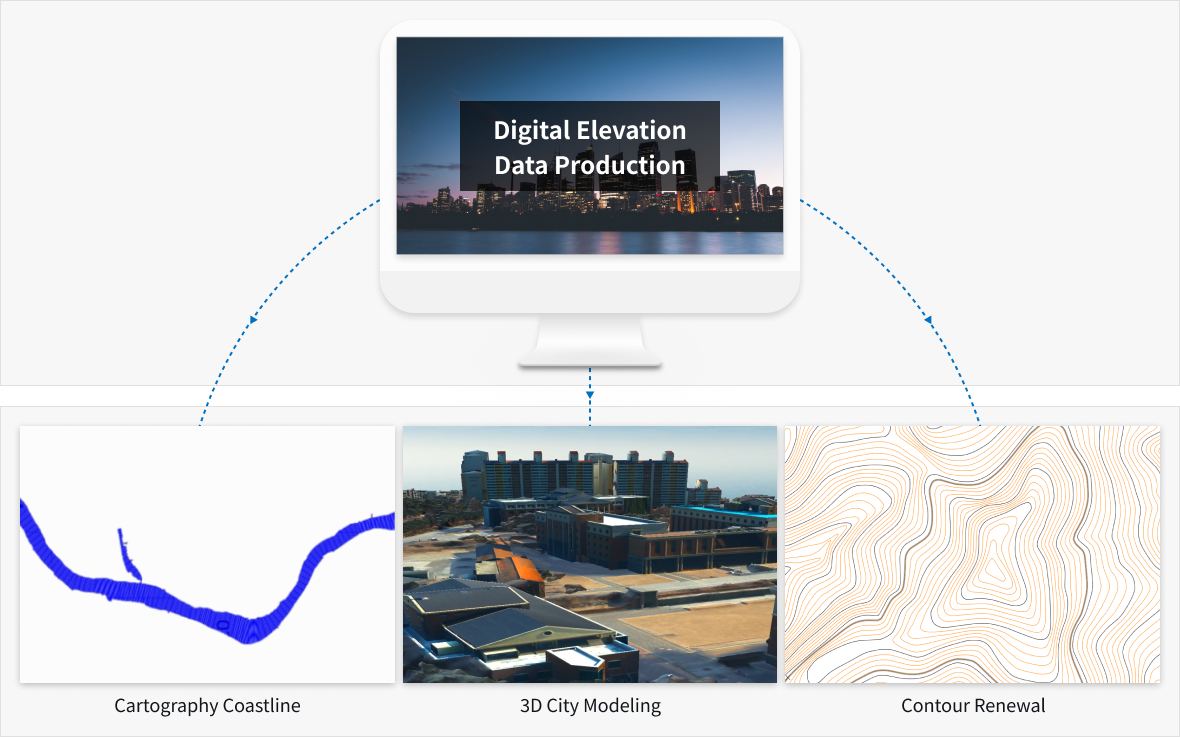
Digital Elevation Data Production
Digital Elevation Data Production is a ground surface model produced in a grid form using digital ground data or irregular triangular network data. Production methods include aerial laser surveying, using the contour layer of the digital map, image matching, and using field surveying results. The digital elevation data includes a Digital Elevation Model (DEM) and a Digital Terrain Model (DTM) that express parts except buildings, artificial structures, and trees, and a Digital Surface Model (DSM) that includes all information such as buildings, artificial structures, and trees.
DEM 1
DSM 1
Result
DEM 2
DSM 2
Major Application Field
Digital Elevation Data Production Procedure
Step. 01
Airborne Laser Scanning
Step. 02
Data Preprocessing
Step. 03
BoreSight Calibration
Step. 04
Generating Raw Data
Step. 05
Surveying Ground Control Points
Step. 06
Automatic Classification of Topographic Features
Step. 07
Orthometric Height Conversion
Step. 08
Digital Elevation Model Production
Step. 09
Digital Surface Model Production
Step. 01
Step. 02
Step. 03
Airborne Laser Scanning
Data Preprocessing
BoreSight Calibration
Step. 04
Step. 05
Step. 06
Generating Raw Data
Surveying Ground Control Points
Automatic Classification of Topographic Features
Step. 07
Step. 08
Step. 09
Orthometric Height Conversion
Digital Elevation Model Production
Digital Surface Model Production
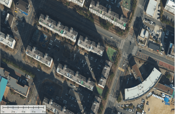
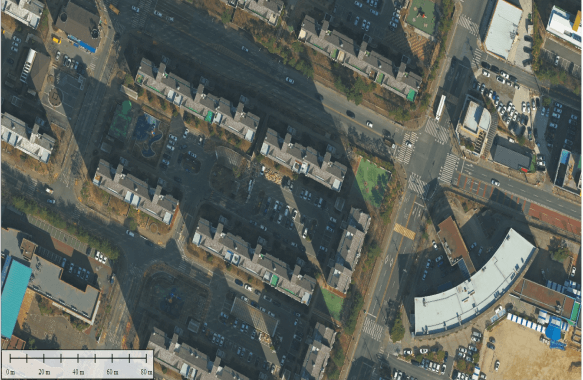
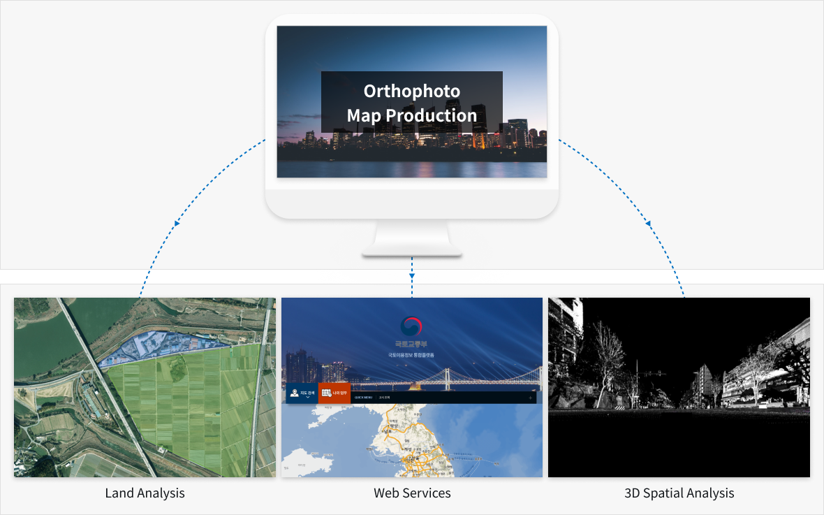
Orthophoto Map Production
Orthophoto is an image that corrects geometric and slope distortion that occur when taking aerial images. In the aerial photographs that have undergone orthogonal correction, the mutual positional relationship of topographic features becomes the same as the map. Therefore, the shape that looks like it is lying on its side in a normal photo is expressed as a vertically looking down image after