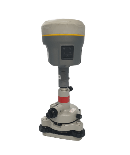
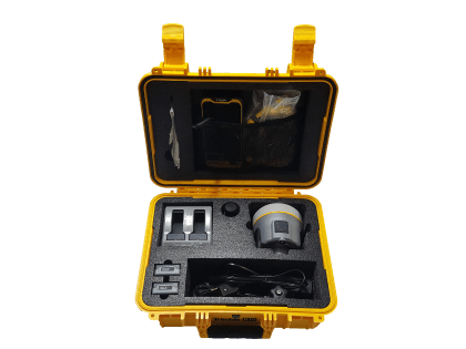
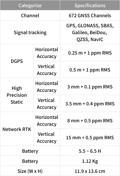
Geodetic survey and various control points survey Obtaining 3D location information
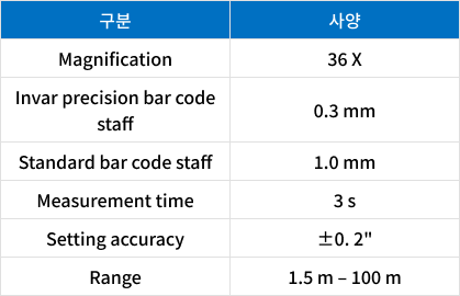
Specification
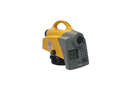
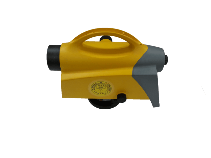
Digital Level
Product Description
TRIMBLE DINI 03
Manufacturer
Trimble
Application
Obtaining elevation information through precise level surveying
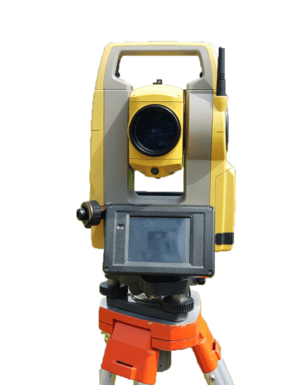
Specification
Total Station
Product Description
TOPCON OS 101
Manufacturer
TOPCON
Application
Construction survey: Building perimeter, height, location, etc. (3D surveying) Cadastral survey: Proof of location of building land Inaccessible positioning: Hazardous site, high temperature target surveying
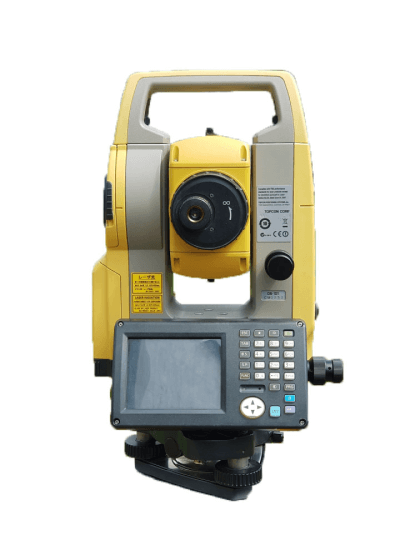
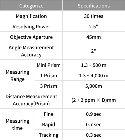
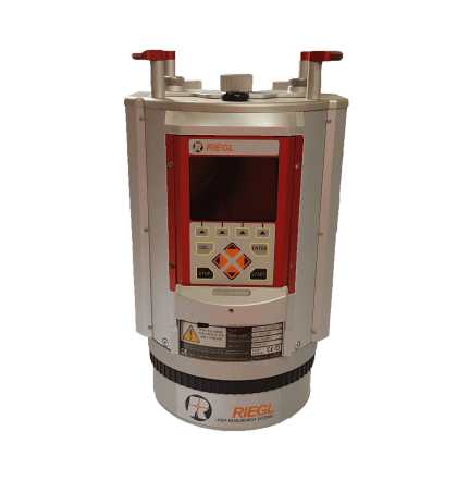
Specification
Product Description
TOPCON OS 102
Manufacturer
TOPCON
Application
Construction survey: Building perimeter, height, location, etc. (3D surveying) Cadastral survey: Proof of location of building land Inaccessible positioning: Hazardous site, high temperature target surveying
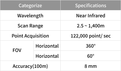
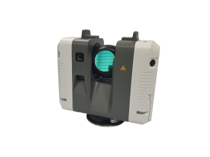
Specification
3D Laser Scanner
Product Description
RIEGL VZ-1000
Manufacturer
RIEGL
Application
Urban modeling Exterior survey of building As-Built surveying 3D Geospatial information manufacturing
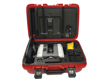
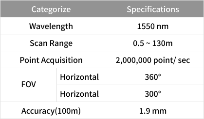
Specification
Product Description
Leica RTC360 3D Laser Scanner
Manufacturer
Leica
Application
Urban modeling Exterior survey of building As-Built surveying 3D Geospatial information manufacturing
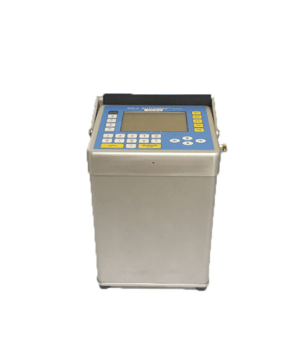
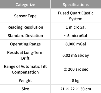
Specification
Gravitational Meter
Product Description
CG-5 AUTOGRAV
Manufacturer
Scintrex
Application
Measurements of abnormal gravity within the Earth are taken to understand the internal structure The utilization of exploration for resources(petroleum, gas, etc) Determine the shape, geoid, and vertical deviation of the Earth